Description
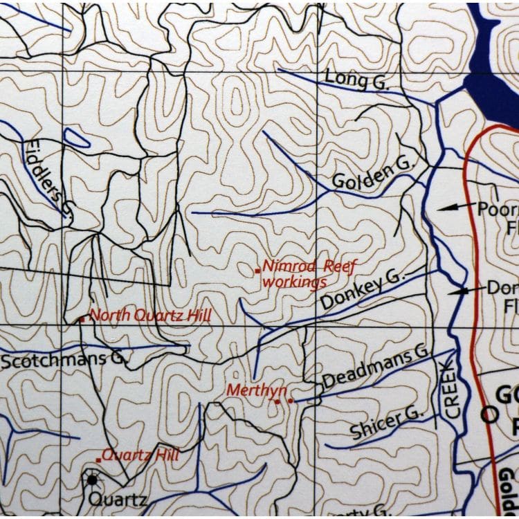
The Map is printed on an A2 sheet and covers the mines of the Castlemaine Gold Diggings. The mines are shown in red. The scale is 1: 33,330. The mapped area is about 11 by 16 km and covers Barkers Ck to Glenluce and Guildford to Faraday. The map shows places, contours at 10 m intervals, road and railways. Streams are included but some minor streams have been altered.. The map is delivered, rolled in a posting tube. The image here shows a detailed section of the map.
Ref: 63150


Reviews
There are no reviews yet.